
NASA scientists are mapping ground changes on earthquake-prone islands like Tutuila, the largest American Samoa island, in this #Landsat 8 image.🏝️
They found that Tutuila sank an average 6-9 mm per year from 2015-2022, compared to 1-2 mm before 2009. go.nasa.gov/3r1XRKg
#NASAEarth
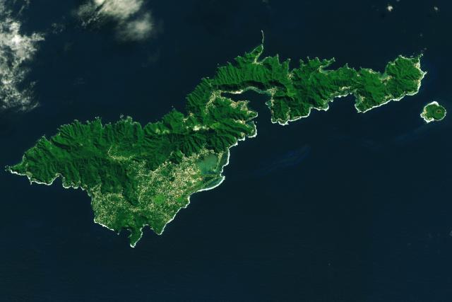
Tutuila Island, American Samoa
Volcanoes, rainforests, and reefs abound in this tropical U.S. territory.go.nasa.gov