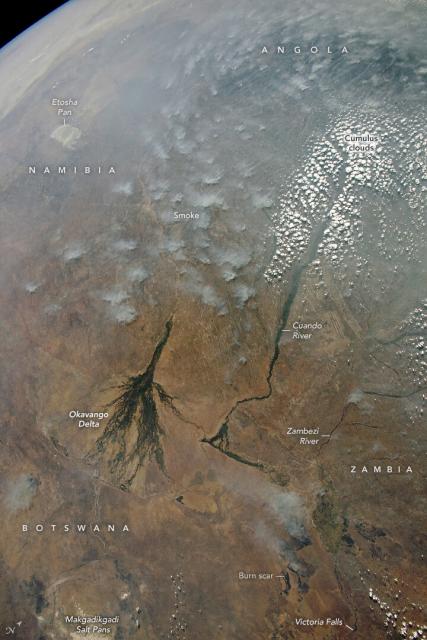
Over the Cuando River basin (upper right corner in this image) a cloud free line traces the course of a river.
This line reflects a zone of cooler air directly above the river where cloud development is suppressed—at least on days with little wind.
#NASAEarth
