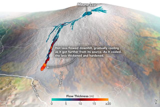
Scientists mapped the thickness of the lava flows from Mauna Loa with @nasa aircraft. 🌋🛩
The airborne data is overlaid on a #Landsat 8 image with topography from a digital elevation model.
Thicker lava flows are shown in yellow and thinner in teal.
#NASAEarth