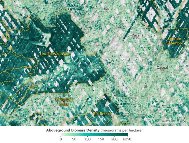
This map shows GEDI biomass density data in Rondônia in western Brazil overlaid with the boundaries (in yellow) of protected areas like the Uru-Eu-Wau-Wau indigenous territory.
Biomass is much denser (dark green) within the protected area. More: go.nasa.gov/3ptW5RU
#NASAEarth
Protected Areas Safeguard Climate
Protecting carbon stored in ecosystems could be a powerful tool in tackling climate change.go.nasa.gov
