3 years ago • •
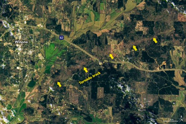
This #Landsat 9 image shows the path of a subsequent, weaker tornado near Winona, Mississippi.
(The path of the stronger tornado was outside the view of Landsat 9.)#NASAEarth
Lo, thar be cookies on this site to keep track of your login. By clicking 'okay', you are CONSENTING to this.