
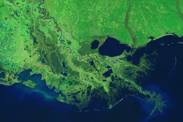
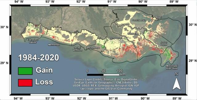
In a new study, scientists used #Landsat imagery from @nasa/@usgs to track shoreline changes and dramatic wetlands losses in Louisiana from 1984 to 2020.
The state lost nearly 21 square miles of important and vulnerable wetland ecosystems every year. go.nasa.gov/3UVZHFN
#NASAEarth
Satellites Help Scientists Track Dramatic Wetlands Loss in Louisiana
New research uses NASA satellite observations and advanced computing to chronicle wetlands lost (and found) around the globe.Kate Ramsayer (NASA)