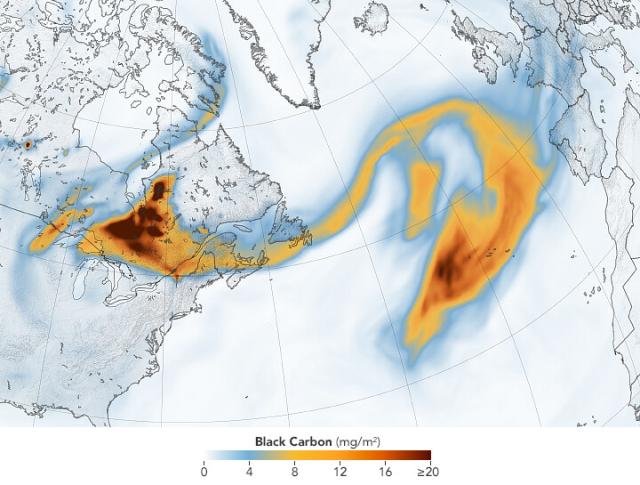
This map shows the density of black carbon particles – or soot – from North America across over 2,000 miles of the Atlantic Ocean.
The data come from @NASAGoddard’s GEOS-FP model that combines satellite, aircraft, and ground-based meteorological data. go.nasa.gov/3r0DoWl
#NASAEarth
Canadian Smoke Reaches Europe
Smoke from wildland fires in Canada traversed the Atlantic Ocean and drifted over European countries including Portugal and Spain.go.nasa.gov
