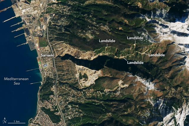
Scientists are using satellite images to locate landslides following the devastating earthquakes in parts of Türkiye and Syria on February 6, 2023.
This #Landsat 9 image shows small landslides along a valley east of Sarıseki, Türkiye, on Feb. 14. go.nasa.gov/3IROLGI
#NASAEarth
Landslides in Türkiye
Scientists are using satellite images to locate landslides following the powerful earthquakes that struck in early February.go.nasa.gov
