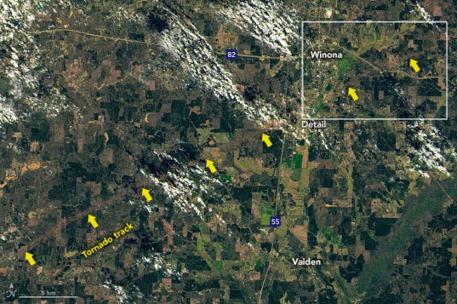
A tornado moved through Mississippi on March 24, leaving a 29-mile-long tornado track near the city of Winona.
The tornado’s path is visible in #Landsat satellite imagery captured the next day. https://go.nasa.gov/42Oq1He
#NASAEarth
The tornado’s path is visible in #Landsat satellite imagery captured the next day. https://go.nasa.gov/42Oq1He
#NASAEarth
Tornado Leaves Path of Destruction in Mississippi
A deadly tornado left a 29-mile-long path near Winona, which is visible in satellite images.go.nasa.gov
Mother Bones
in reply to NASA • • •A satellite image of the area, with intermittent yellow arrows indicating what looks like a dirt trail scored across hundreds of miles through the landscape