Search
Items tagged with: nasaearth
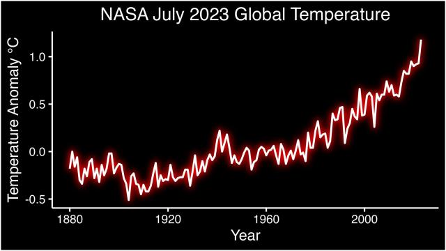
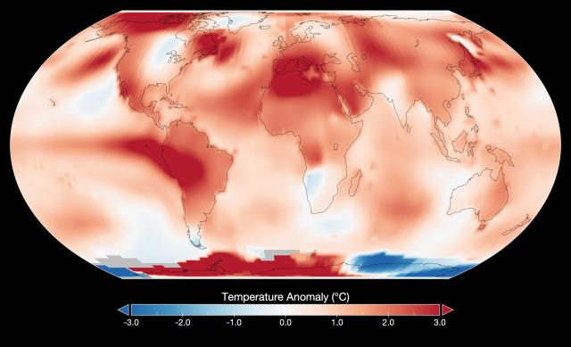
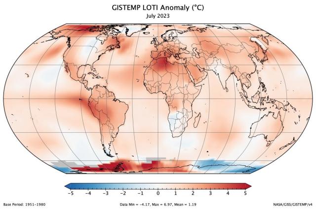
NASA confirms: this July was the hottest month on record.🌡️go.nasa.gov/3qwsszU
Our record starts in 1880, when consistent global recordkeeping became possible. It shows an undeniable pattern of increasing global temperatures, primarily from human emissions of carbon dioxide.
#NASAEarth
NASA Clocks July 2023 as Hottest Month on Record Ever Since 1880
According to scientists at NASA’s Goddard Institute for Space Studies (GISS) in New York, July 2023 was hotter than any other month in the global temperature record.Claire O’Shea (NASA)
#NASAEarth
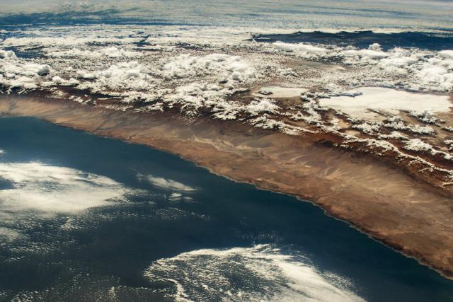
#DYK? The Chilean Andes cause a rain shadow effect that results in minimal precipitation in the Atacama Desert, making it one of the driest places on Earth!
📷 : @Space_Station
📍: Chilean Andes, South America
go.nasa.gov/3DRvLEY
#NASAEarth
Looking Down on the Andes
The South American mountain range intercepts moisture, producing a distinct transition from rainforest to desert.go.nasa.gov
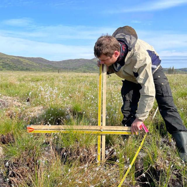
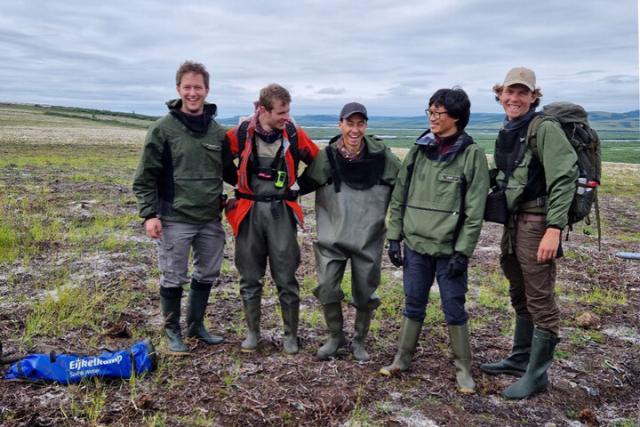
In 2022, severe lightning ignited fires in Alaska. 🔥
A year later, @VUamsterdam scientists with @nasa’s ABoVE project are studying the burned tundra to understand how Arctic fires impact plants, soil, permafrost and more. go.nasa.gov/3DQ2fiF
#NASAEarth
Notes from the Field - Expedition to Alaska’s Burned Tundra
climate change, global climate change, global warming, natural hazards, Earth, environment, remote sensing, atmosphere, land processes, oceans, volcanoes, land cover, Earth science data, NASA, environmental processes, Blue Marble, global mapsgo.nasa.gov
#NASAEarth
#NASAEarth
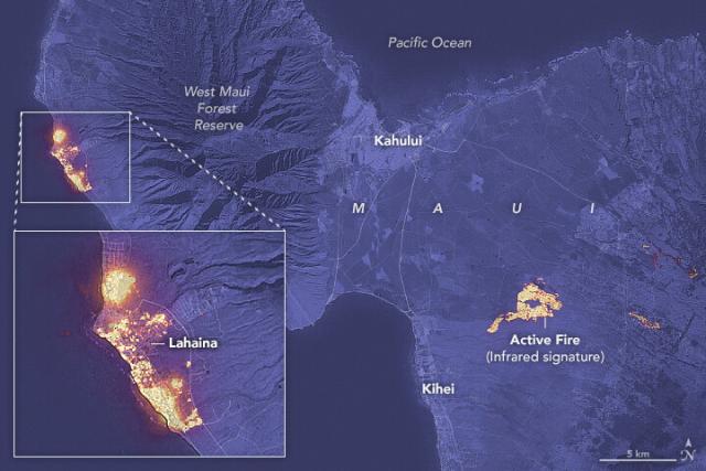
Devastation in Maui
Strong winds and dry weather helped fuel destructive wildfires on Hawaii’s second-largest island.go.nasa.gov
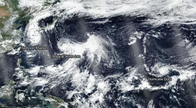
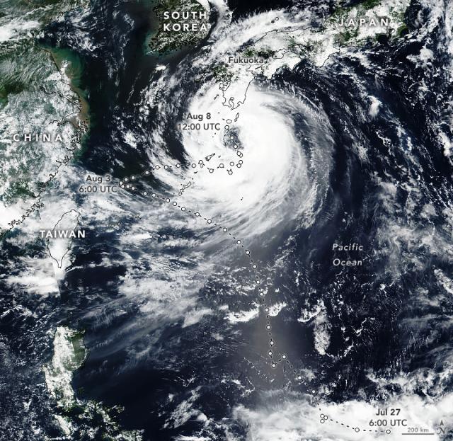
Tropical Cyclone Khanun took a zigzagging path toward the Korean Peninsula.
The @NOAA-@nasa satellite Suomi NPP captured this image on August 8 when the storm had maximum sustained winds of 80 kilometers (50 miles) per hour. go.nasa.gov/3qnk6KX
#NASAEarth
A Zigzagging Path for Khanun
The storm is heading for South Korea after winding its way through the Ryukyu Islands.go.nasa.gov
#NASAEarth
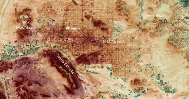
NASA Data Shows Fierce Surface Temperatures During Phoenix Heat Wave
Streets and other built surfaces in the region absorbed and retained heat long after sunset and grew hotter over many days of persistent high temperatures.Naomi Hartono (NASA)
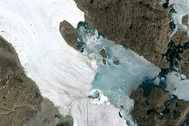
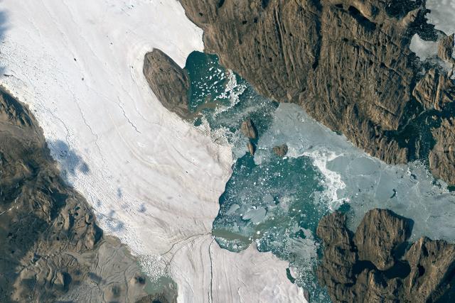
Seasonal warmth led to the rapid disintegration of sea ice near two large outlet glaciers in Greenland. 🌊🧊
A pocket of persistent open water – or polynya – had formed within the sea ice on July 21 (left). By July 25 (right), the sea ice had broken out. go.nasa.gov/3YntuL7
#NASAEarth
Summer Breakout in Northeast Greenland
Seasonal warmth led to the rapid disintegration of sea ice near the junction of two large outlet glaciers.go.nasa.gov
NASA’s upcoming PACE mission will help scientists learn more about ocean ecology, including the species of phytoplankton present in blooms and the rates of their growth.
PACE is launching no earlier than January 2024. go.nasa.gov/45jhkFq
#NASAEarth
NASA PACE - Home
PACE's technologies will provide unprecedented insight into Earth's ocean and atmosphere, which impact life by regulating climate and making Earth habitablego.nasa.gov
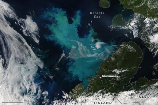
A break in the clouds above the Barents Sea, one of the cloudiest places in the world. ☁️🌊☁️
Milky blue swirls of phytoplankton are present in this view from @nasa’s Terra satellite on Aug. 3. go.nasa.gov/3OxCGIq
#NASAEarth
A Bloom in a Changing Barents Sea
A break in the clouds offered a glimpse of phytoplankton north of Norway, Finland, and Russia.go.nasa.gov
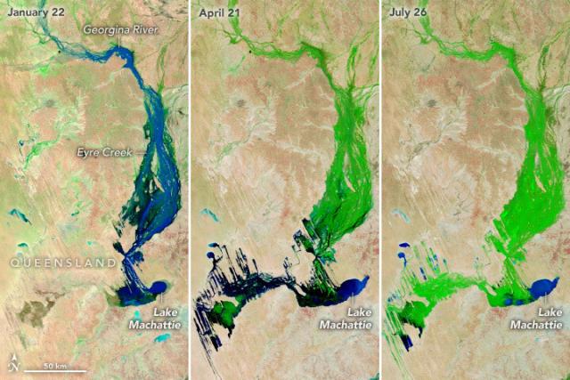
Prolonged heavy rains in northern Australia set off new plant growth across Channel Country.
More vegetation grew in areas like the Lake Eyre Basin, seen in these enhanced-color images from @nasa’s Terra satellite.
🌧️🌱: go.nasa.gov/47jc9a5
#NASAEarth
A Series of Inundating Events
Repeated heavy rains in Australia set off waves of new growth across Channel Country.go.nasa.gov
#NASAEarth
NASA PACE - Home
PACE's technologies will provide unprecedented insight into Earth's ocean and atmosphere, which impact life by regulating climate and making Earth habitablego.nasa.gov
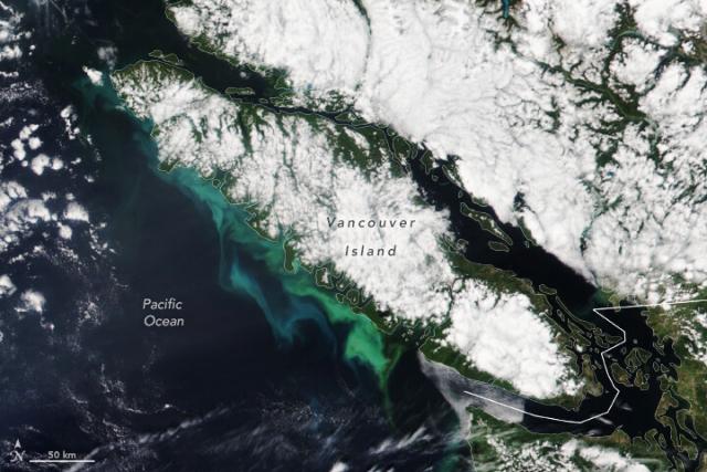
An ocean of color 🎨
Swirls of phytoplankton and sediment colored the coastline of Vancouver Island in shades of turquoise and green. The @NOAA-20 satellite captured this image on July 26, 2023. go.nasa.gov/3KrDOvI
#NASAEarth
Vancouver Island’s Colorful Coastline
Swirls of phytoplankton and sediment brightened the island’s coastal waters in July 2023.go.nasa.gov
#NASAEarth
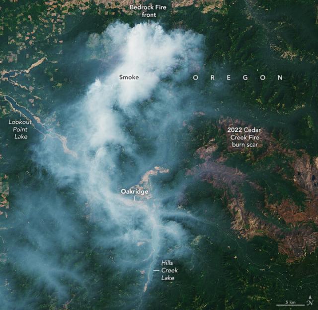
Wildfire season is picking up in the U.S.
60 fires are burning across nine states in the western U.S., fueled by hot and dry conditions. On August 1, #Landsat 9 captured this image of smoke streaming away from the Bedrock Fire in Oregon. go.nasa.gov/3Kscai8
#NASAEarth
Fire Season Heats Up in the West
Following a slow start to the fire season, several blazes burned across the western U.S. in early August.go.nasa.gov
Catching crop disease early 🍇
From the air, a NASA instrument helps spot a wine grape disease before it’s visible to the human eye. This remote sensing technique could help detect early signs of infection in this and other crops. go.nasa.gov/43XFeFk
#NASAEarth
NASA Helps Spot Wine Grape Disease From Skies Above California
In a case study, scientists detected the costly infection in cabernet sauvignon grapevines before they showed symptoms visible to the human eye.Naomi Hartono (NASA)
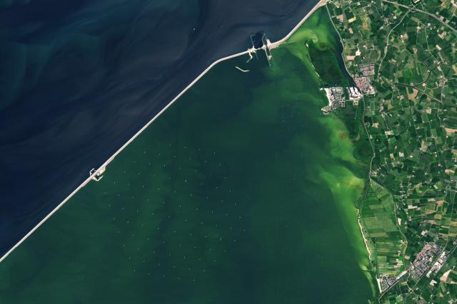
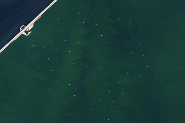
The answer is Windpark Fryslân, the largest freshwater wind farm on Earth!
The array of 89 wind turbines, located in Lake IJssel in the Netherlands, produces enough electricity to power about half a million homes. ⚡🏠 go.nasa.gov/3DJubVC
#NASAEarth
The World’s Largest Freshwater Wind Farm
Windpark Fryslân can produce enough electricity to power about half a million homes in the Netherlands.go.nasa.gov
Ready for a puzzler? 🤔🧩
Tell us where this is, what we’re looking at, and anything interesting about this satellite image. We’ll share the answer at 3pm ET.
#NASAEarth
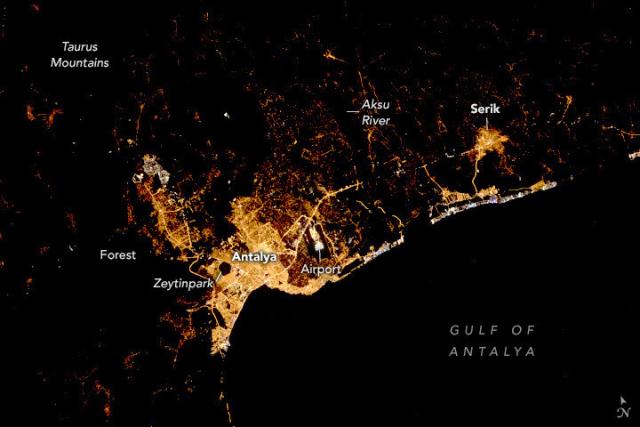
Good evening, Türkiye. 🌃
An astronaut aboard the @Space_Station took this nighttime photograph of the coastal Mediterranean city of Antalya, Türkiye in September 2022, showing the sharp contrast between urban infrastructure and natural areas. go.nasa.gov/3q5u43v
#NASAEarth
Nighttime in Antalya, Türkiye
Urban infrastructure and natural areas stand in sharp contrast at night on the Mediterranean coast.go.nasa.gov
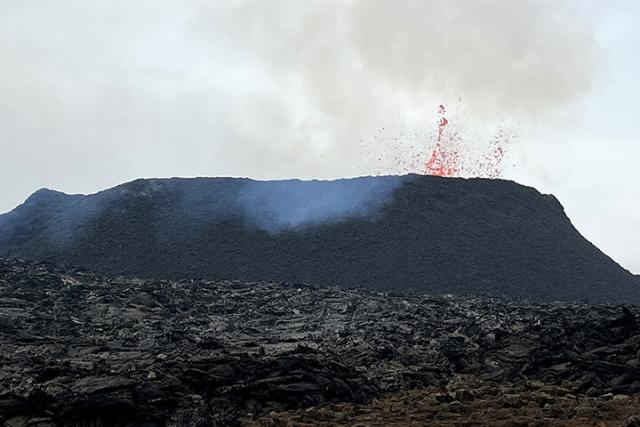
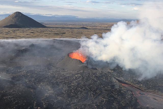
Scientists from the Institute of Earth Sciences at @uni_iceland calculated that the eruption was discharging about 12 cubic meters of lava per second on July 17, similar to the 2021 and 2022 eruptions.
Read the full story: go.nasa.gov/3q98qeJ
#NASAEarth
Lava and Smoke Blanket Fagradalsfjall
Lava is once again spilling from the volcano in southwest Iceland, only this time it is igniting moss fires.go.nasa.gov
Water vapor, carbon dioxide & sulfur dioxide are the most abundant gases in volcanic plumes.
According to satellite sensors like TROPOMI and OMI, winds have mostly pushed the plume over the Atlantic Ocean, but has also affected air quality in Reykjavík.
#NASAEarth
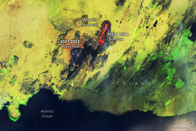
Iceland’s Fagradalsfjall volcano is erupting again, igniting unusually large and long-lasting wildfires in nearby moss that grows atop old lava flows. 🌋
This enhanced-color #Landsat 9 image shows active lava (orange) and burn scars from the moss fires. go.nasa.gov/3q98qeJ
#NASAEarth
Lava and Smoke Blanket Fagradalsfjall
Lava is once again spilling from the volcano in southwest Iceland, only this time it is igniting moss fires.go.nasa.gov
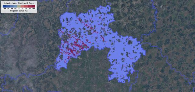
NASA data is helping Bangladeshi rice farmers save water, money, and energy. 🌾
Scientists from @UW and Bangladesh are using satellite data to show farmers how much water they are using, how much they have, and how much their crops need. go.nasa.gov/3KqkVte
#NASAEarth
NASA Data Helps Bangladeshi Farmers Save Water, Money, Energy
Through the Integrated Rice Advisory System program, researchers use NASA and other satellite data to deliver information to Bangladeshi farmers about how much water they are using, how much they have, and how much their crops need.Kate Ramsayer (NASA)
Welcome to Wildfires 101 🔥
Wildfires are an important part of many ecosystems, but climate change is causing fires to burn larger, longer, and more often. @nasa science helps us learn about and prepare for fires in a warmer world. go.nasa.gov/47iWmIA
[Video embedded in original tweet]
#NASAEarth

NASA Tracks Wildfires From Above to Aid Firefighters Below
Every evening from late spring to early fall, two planes lift off from airports in the western United States and fly through the sunset, each headed for an active wildfire, and then another, and another.Jennifer Fadoul (NASA)
Is climate change the same as global warming? Not quite.
The warming of Earth — or global warming — is just one factor that makes up a range of changes that are happening to our planet, which is climate change.
And @nasa is studying all of it: climate.nasa.gov/
[Video embedded in original tweet]
#NASAEarth

Home – Climate Change: Vital Signs of the Planet
Vital Signs of the Planet: Global Climate Change and Global Warming. Current news and data streams about global warming and climate change from NASA.Climate Change: Vital Signs of the Planet
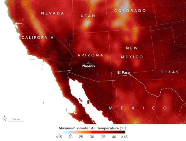
The U.S. Southwest endured more than three weeks of extreme temperatures in July 2023.🌡️
This map shows air temperatures on July 25, 2023 using satellite observations and a @nasagoddard GEOS model. Temperatures over 113°F (45°C) are dark red. go.nasa.gov/44OhEMx
#NASAEarth
Relentless Heat in the Southwest
The desert Southwest endured more than three weeks of extreme temperatures in July 2023.go.nasa.gov
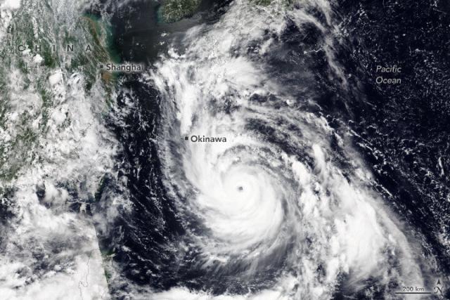
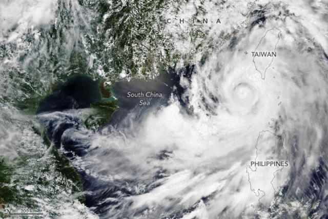
Typhoon Khanun approached China’s coast on the heels of Typhoon Doksuri, which left a trail of destruction in the days prior.
The @noaa-20 satellite captured these images of Typhoons Khanun (left) and Doksuri (right) on July 31 and 27, respectively. go.nasa.gov/3KnkMa2
#NASAEarth
#NASAEarth
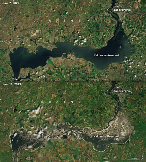
Canals in Ukraine are Drying Up
After the breach of Kakhovka Dam and the flood that ensued, farmers in the area are coping with depleted water supplies.go.nasa.gov
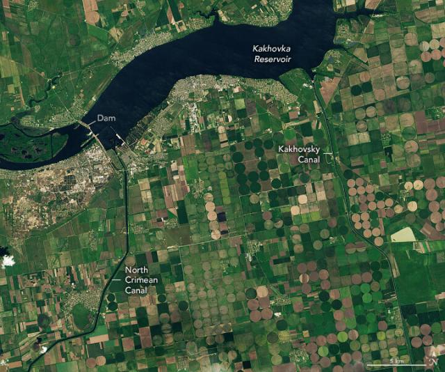
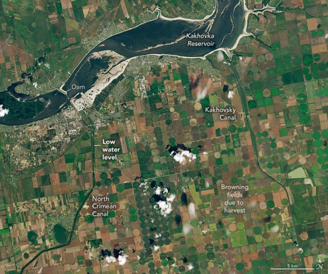
After the breach of Kakhovka Dam in June 2023, the adjacent reservoir drained, leaving farmers in southern Ukraine to cope with depleted water supplies.
These #Landsat images show the reservoir and two canals before (left) and after (right) the breach. go.nasa.gov/3Yh4rt2
#NASAEarth
Canals in Ukraine are Drying Up
After the breach of Kakhovka Dam and the flood that ensued, farmers in the area are coping with depleted water supplies.go.nasa.gov
#NASAEarth
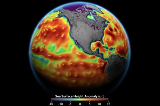
Sea Level | NASA Global Climate Change
Vital Signs of the Planet: Global Climate Change and Global Warming. Current news and data streams about global warming and climate change from NASA.Climate Change: Vital Signs of the Planet
#NASAEarth
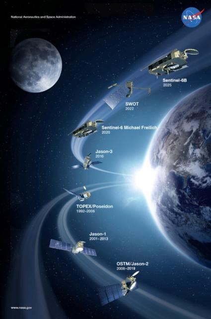
Sentinel-6 Michael Freilich Satellite
Designed to measure the height of the ocean - a key component to understanding how Earth's climate is changing - Sentinel-6/Michael Freilich consists of two identical satellites that will be launched five years apart.NASA Jet Propulsion Laboratory (JPL)
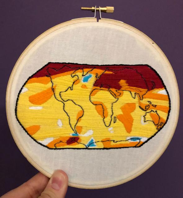
NASA communicator Katy Mersmann gets inspiration from the science she works with.
Her piece is based on a data visualization of @NASAGISS GISTEMP's 2020 global surface temperature anomalies. 2020 is currently tied for the warmest year on record. go.nasa.gov/2XDI6rh
#NASAEarth
2020 Tied for Warmest Year on Record, NASA Analysis Shows
Earth’s global average surface temperature in 2020 tied with 2016 as the warmest year on record, according to an analysis by NASA.Katherine Brown (NASA)
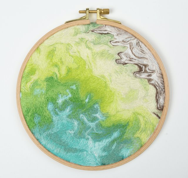
On #WorldEmbroideryDay, Earth inspires some creative threads. 🧵🌎
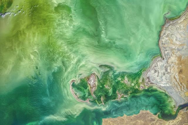
Artist Danielle Currie titled her piece 46.69, 50.43 after the coordinates of an image caught by #Landsat 8 of the Caspian Sea. go.nasa.gov/3Y8TI3E 🌊
#NASAEarth
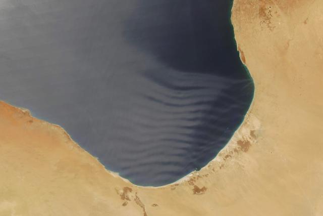
Making (atmospheric) waves ☁️🌊
A thin layer of Saharan dust in the atmosphere helped expose gravity waves along the coast of Libya.
The @nasa Aqua satellite captured this image on July 9, 2023. go.nasa.gov/44xGnV7
#NASAEarth
Dusty Waves Over the Gulf of Sidra
A thin layer of dust in the atmosphere helped expose gravity waves along the coast of Libya.go.nasa.gov
Researchers from @BoiseState and @USUAggies are using data from @nasa’s Earth satellites to measure beaver restoration impacts across Idaho and Utah – and help ranchers reintroduce beavers to their land.
🦫: go.nasa.gov/3XXfDuE
[Video embedded in original tweet]
#NASAEarth

"Beaver Believers" See Impacts of Rewilding Via NASA Data
Researchers are using NASA Earth observations to monitor impacts of beaver restoration on water availability in drought-prone ecosystems.Aries Keck (NASA)
