Search
Items tagged with: nasaearth
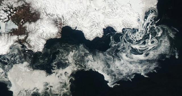
During the 2022-2023 winter, the extent of sea ice in the Arctic was below average according to the @nsidc. 🧊
In the Sea of Okhotsk, sea ice extent has decreased about 9% per decade from 1979-2010, according to a recent study from scientists in Japan. go.nasa.gov/3P82Lj6
#NASAEarth
Ice Swirls in the Sea of Okhotsk
Ice breaking up off the Russian coast whirled at the whims of winds and currents.go.nasa.gov
Meet Kellin Slater, @ColoradoStateU environmental epidemiologist using ground monitors and @nasa satellite data to better understand how wildfire and prescribed burning translate to community health. 🔥
Learn more: bit.ly/3lv9jvJ
#NASAEarth
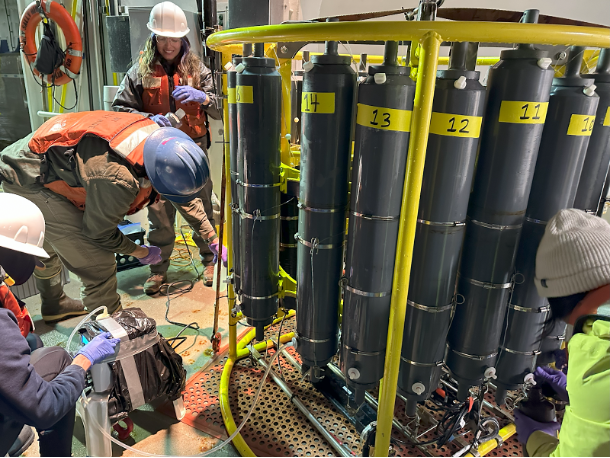
In biological oceanography, it helps to have a good filter 🙊
Scientists with @nasa’s S-MODE mission are on a research vessel, filtering samples of water to remove particles and tiny organisms like phytoplankton. go.nasa.gov/3MSpfls
#NASAEarth
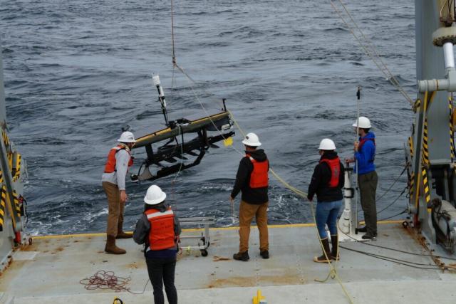
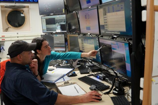
Day in the life of an ocean scientist 🌊
Come aboard a research ship with Mara Freilich to study ocean currents with @nasa’s S-MODE mission.
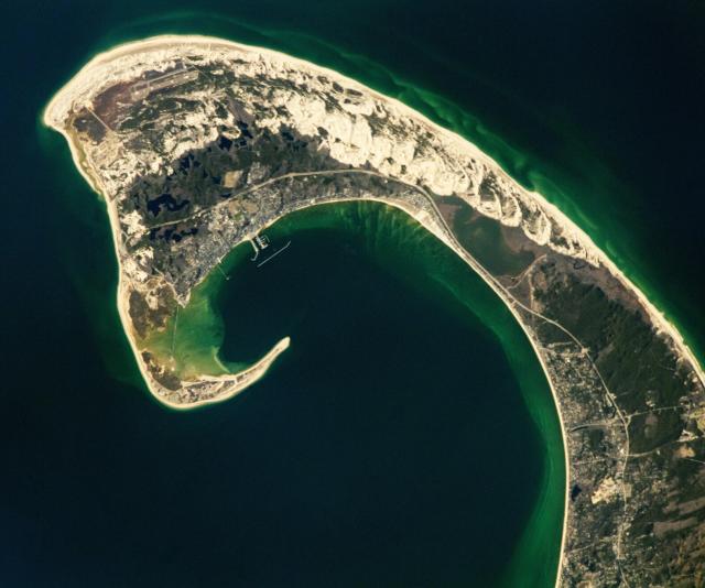
Hooked on Cape Cod 😍🪝
A @Space_Station astronaut took this photograph of the iconic hook-shaped peninsula of Cape Cod. Sand dunes and freshwater ponds are visible to the North, within the Cape Cod National Seashore.
Hooked on Cape Cod
Dunes, ponds, and wildlife habitat are found alongside urban areas on this iconic peninsula in Massachusetts.go.nasa.gov
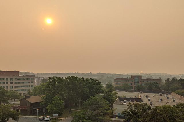
Smoke from the Canadian wildfires has caused historically poor air quality in the northeastern U.S.
This animation shows how black carbon particles, or soot, moved across eastern portions of Canada and the U.S. from June 3–8, 2023.
go.nasa.gov/3oVEGBf
#NASAEarth
Hazardous Air Chokes Northeastern States
Smoke originating from Canadian wildfires caused historically poor air quality.go.nasa.gov
Go, go, Phyto Phyters! 🥊 🌊
What phytoplankton lack in size, they make up in numbers. These tiny marine organisms photosynthesize to produce oxygen and store carbon in Earth’s oceans. #WorldOceansDay
🎥 youtu.be/1xl5Z1d3wcQ
#NASAEarth
The Insanely Important World of Phytoplankton
Ivona Cetinić, the Science Lead for Ocean Biogeochemistry for PACE (Plankton, Aerosol, Cloud, ocean Ecosystem) describes the weird, wonderful and important w...YouTube
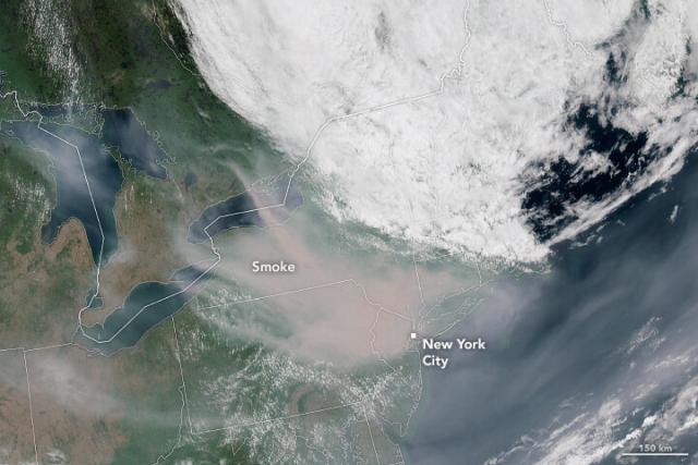
Fires in Quebec have delivered one of the most intense outbreaks of smoke seen in the eastern U.S. in decades.
This image from @NOAA’s GOES-16 shows smoke sweeping into New York and Pennsylvania on the morning of June 7.
Are wildfires getting worse? Unfortunately, yes.
Changes in our climate have led to wildfires increasing in intensity, severity, size and duration.
@NASAClimate expert Liz Hoy explains: go.nasa.gov/3CiepjF
#NASAEarth
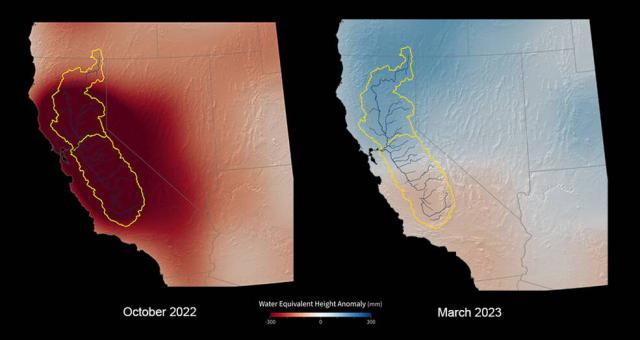
How did winter storms affect California’s water supply?
Data from the GRACE-FO satellite show the greatest net gain of water over the winter in nearly 22 years, but the state’s groundwater, used for irrigation, could take years to fully recharge.
🔗 go.nasa.gov/3oWQ2F1
#NASAEarth
US-German Satellites Show California Water Gains After Record Winter
Early data shows the greatest net gain of water over the winter in nearly 22 years, but the state’s groundwater levels still suffer from the effects of years of drought.Naomi Hartono (NASA)
#NASAEarth
How do we know what Earth's climate was like long ago?
If you look closely, there are clues just about everywhere across our globe. Some are easy to see and others are more subtle. @NASAClimate scientist Dr. Gavin Schmidt explains more. Want even more?: climate.nasa.gov/faq/20/how-do…
#NASAEarth
How do we know what greenhouse gas and temperature levels were in the distant past? – Climate Change: Vital Signs of the Planet
Vital Signs of the Planet: Global Climate Change and Global Warming. Current news and data streams about global warming and climate change from NASA.Climate Change: Vital Signs of the Planet
Refill, please! 🥛
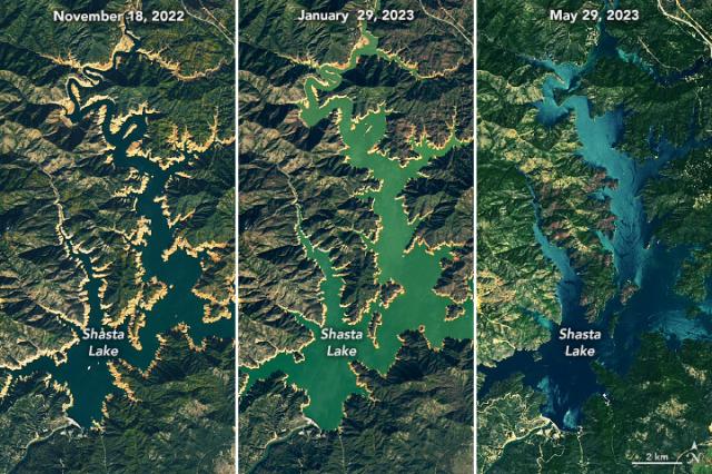
Shasta Lake, California’s largest reservoir, filled to nearly 100% capacity last month. Heavy rains and meltwater from an above-average snowpack earlier this year helped counter a prolonged drought. go.nasa.gov/43Pmok7
#Landsat watched it fill up ⤵️
#NASAEarth
California Reservoir Rebound
Shasta Lake refilled in spring 2023 after a season of heavy rain and snowmelt.go.nasa.gov
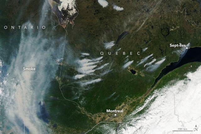
Fires are still burning in Canada.
New fires – some caused by lightning – raged in Quebec in early June, prompting evacuations and air quality warnings.
@nasa’s Aqua satellite captured this image of smoke from the fires on June 3, 2023. go.nasa.gov/3oQEN10
#NASAEarth
#NASAEarth
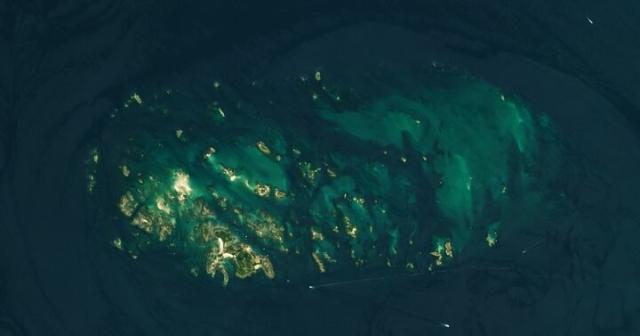
Ebb and Flow in the Chausey Islands
Short caption: Some of the planet’s most extreme tides are found in this French archipelago.go.nasa.gov
Go with the flow this #OceanMonth 🌊
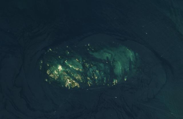
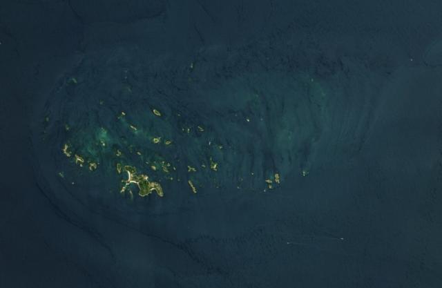
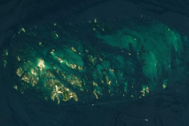
France’s Chausey Islands, located in the English Channel, experience some of the largest tidal ranges on Earth.
365 islands are present during low tide (left image), but only 52 remain when tides are high (right). go.nasa.gov/3J3Cyyb
#NASAEarth
Ebb and Flow in the Chausey Islands
Short caption: Some of the planet’s most extreme tides are found in this French archipelago.go.nasa.gov
It’s puzzler time 🧩
Tell us what we’re looking at and where in the world this is. Bonus points if you can tell us why it’s interesting!
We’ll share the answer at 3 p.m. EST. go.nasa.gov/43gMVH3
#NASAEarth
Earth Matters - May Puzzler
climate change, global climate change, global warming, natural hazards, Earth, environment, remote sensing, atmosphere, land processes, oceans, volcanoes, land cover, Earth science data, NASA, environmental processes, Blue Marble, global mapsgo.nasa.gov
Watching a breakup like 🫣🧊
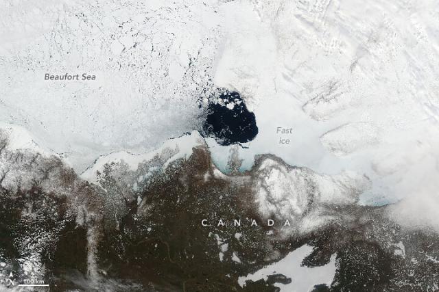
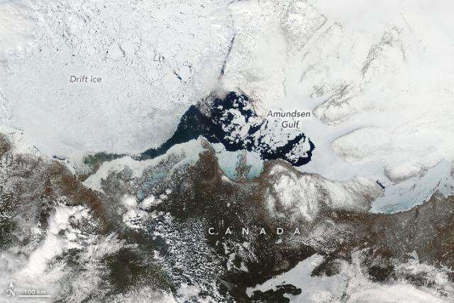
NASA’s Aqua satellite captured these images of the Amundsen Gulf in northern Canada before (left) and after (right) fast ice broke up in late May of 2023. go.nasa.gov/43H72hl
#NASAEarth
Splintering Sea Ice in the Amundsen Gulf
Sea ice crumbled rapidly in the waters of northern Canada as conditions changed in May.go.nasa.gov
Two weeks of skis and snowmobiles and snowshoes, temperatures down to -40F, and countless frozen granola bars.
This is the life of scientists studying snow in Alaska with @nasa’s SnowEx mission. ❄️
Watch the mini doc:
youtube.com/watch?v=E0XnW_41bn…
#NASAEarth
The Science of Snow: Digging for Data
It takes a lot of field work in challenging conditions to gather important snow data. This is the story of NASA’s last SnowEx campaign and those who particip...YouTube
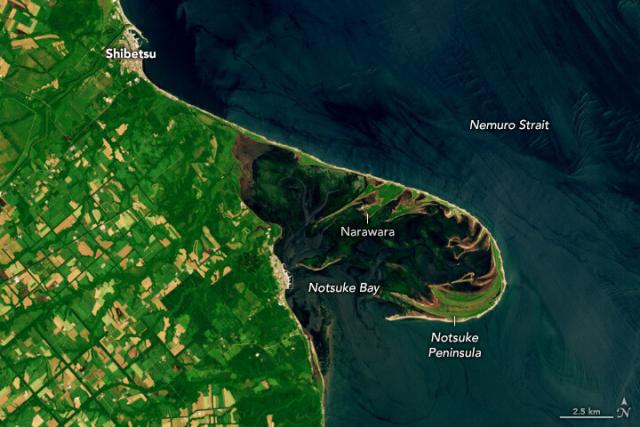
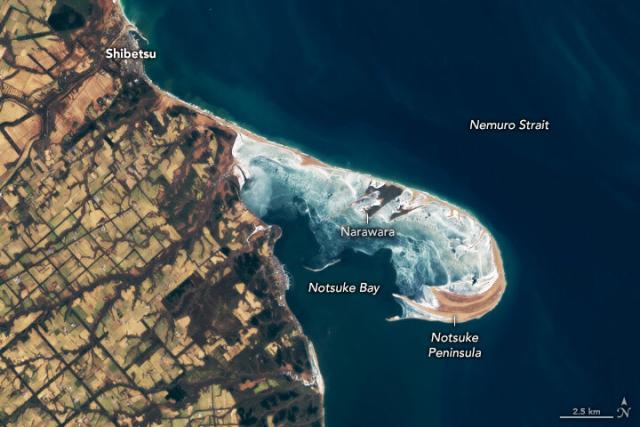
Are you a summer or winter person? ☀️❄️
The Nemuro Strait in these #Landsat images is one of the largest sand spits in Japan. In the summer, sea grass and kelp can be seen in Notsuke Bay, while in the winter, the bay’s shallow waters freeze over.
A Sandy Haven in Japan
The shallow waters of hook-shaped Notsuke Peninsula shelter sea grass and shrimp in eastern Hokkaido.go.nasa.gov
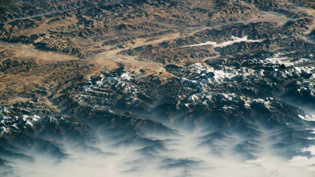
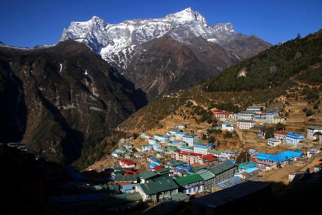
Foggy mornings in the Himalayas… gotta love those @Space_Station views 🏔️😍
Can you spot Everest in this photo?
go.nasa.gov/43tFlIS
#NASAEarth
A Foggy Himalayan Morning
Sunrise is an opportune time to photograph fog as it rolls through the mountain range.go.nasa.gov
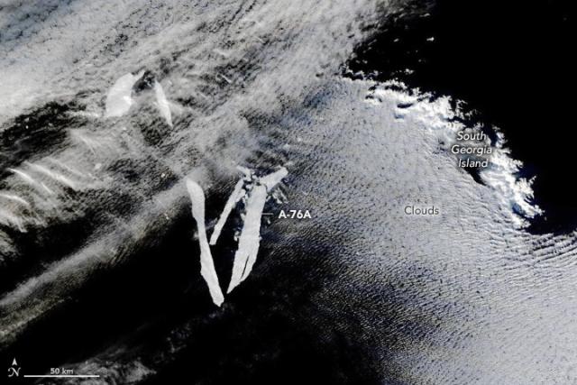
Keep your eyes on the berg 👀 🧊
NASA’s Terra satellite captured Iceberg A-76A splintering into smaller pieces near the remote island of South Georgia. A-76A broke off from A-76 shortly after the initial calving event two years ago. go.nasa.gov/3WJ602h
#NASAEarth
Shrinking Iceberg A-76A
The waters off the remote island of South Georgia splintered another Antarctic iceberg.go.nasa.gov
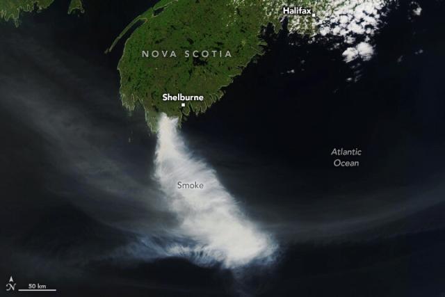
Fires blazed in western Canada for much of May 2023.
Recently, dry and windy conditions fueled the spread of unusually large fires in Nova Scotia in eastern Canada as well. go.nasa.gov/3MGMFtX
#NASAEarth
Raging Fires in Nova Scotia
Dry and windy conditions fueled the spread of unusually large fires in eastern Canada.go.nasa.gov
What’s that rumble?
Scientists at @nasajpl are testing a new technology that may detect tsunamis by the ripples of energy they send toward the atmosphere. The goal is to enhance early warning systems and help communities prepare.
How it works: go.nasa.gov/3OOdEpX
#NASAEarth
NASA Researchers Detect Tsunamis by Their Rumble in the Atmosphere
New hazard-monitoring technology uses GPS signals to go wave-hunting in the Pacific Ring of Fire. GUARDIAN’s long-term objective is to augment early warning systems.Naomi Hartono (NASA)
#NASAEarth
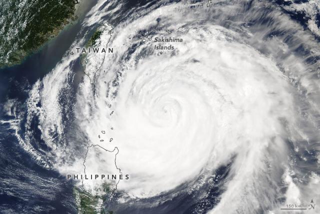
Typhoon Mawar, also called Betty, grew to be one of the strongest May storms on record, reaching category-5 strength in the Philippine Sea.
NASA’s Aqua satellite captured this image of Mawar on May 30 as it turned north and away from Taiwan. go.nasa.gov/42focSb
#NASAEarth
#NASAEarth
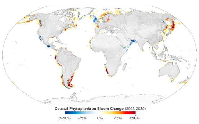
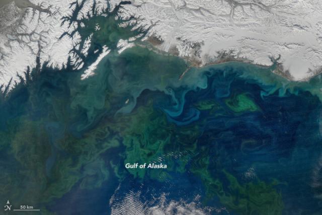
In the future, NASA’s PACE mission will see the ocean in more color than ever before, allowing researchers to tease apart which species of phytoplankton are present in blooms.
Full story ⤵️ go.nasa.gov/45AaWuf
#NASAEarth
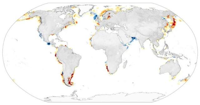
Coastal Phytoplankton on the Rise
Blooms of the plant-like organisms near coastal areas have become more frequent in the 21st century.go.nasa.gov
#NASAEarth
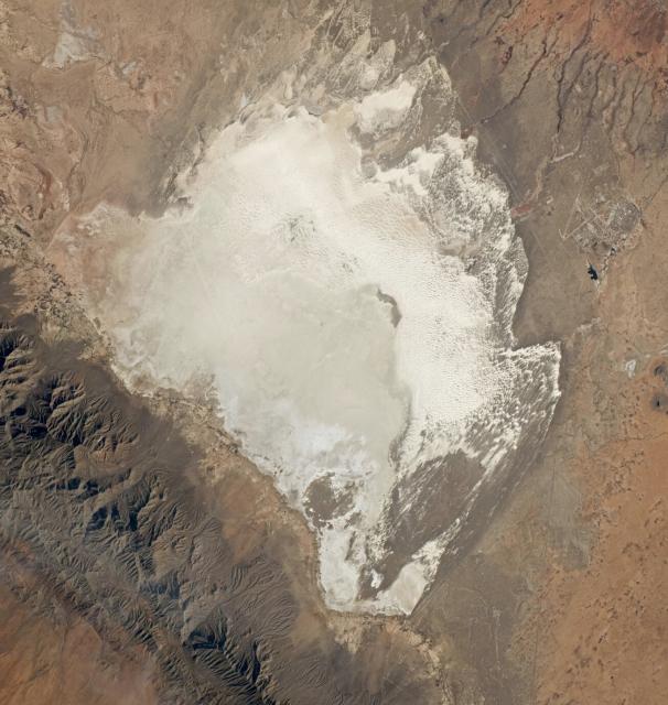
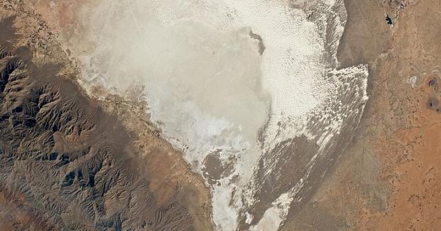
New Mexico’s White Sands
A national park and a dune field occupy part of this bright-white desert landscape, which also has ties to the aerospace industry.go.nasa.gov
Data incoming!
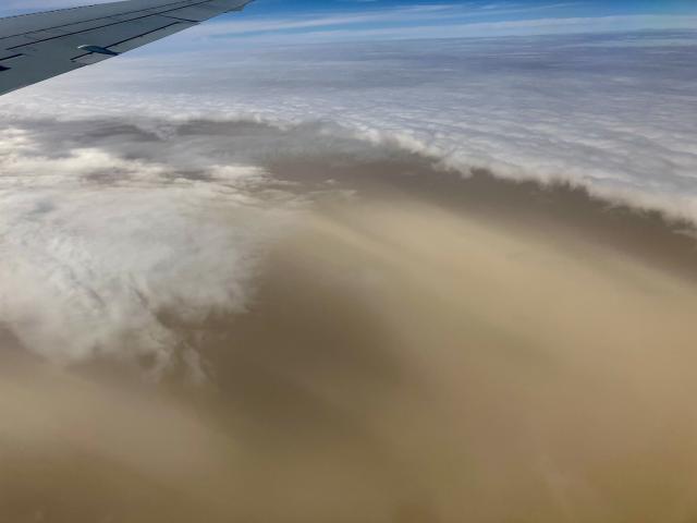
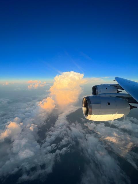
@nasa’s CPEX-CV mission flew off the coast of Cabo Verde in 2022 to study infant storms and how dust, moisture and other factors affect storm intensification. The data is now available to the public. #OpenScience go.nasa.gov/3BWzdNl
#NASAEarth
Teamwork makes TROPICS work 🛰️🛰️
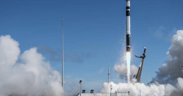
Launching two pairs of small satellites into criss-crossing orbits will allow TROPICS to measure storms near the equator almost every hour. go.nasa.gov/43efNjm
#NASAEarth
NASA, Rocket Lab Announce Coverage for Second TROPICS Launch
After successfully launching the first pair of small satellites earlier this month from New Zealand, NASA and Rocket Lab are now targeting no earlier than 1:30 a.m. EDT Monday, May 22 (5:30 p.m.Roxana Bardan (NASA)
Intense fires in Canada, fueled by unusually hot and windy weather, produced smoke that covered skies in May 2023.
This animation shows the volume of soot from @nasa’s GEOS-FP model, which combines satellite, aircraft and ground measurements. go.nasa.gov/3owCIXP
#NASAEarth
A Smoky May for North America
Fierce fires in Canada are the source of smoke that has swirled across much of the continent.go.nasa.gov
Meet Emily Gargulinski, a @NASA_Langley scientist who watches fires from space. 🔥
She uses geospatial data to evaluate what's happening with those fires on the ground, better understanding their impacts on farmers, communities, and more: haqast.org/
#NASAEarth
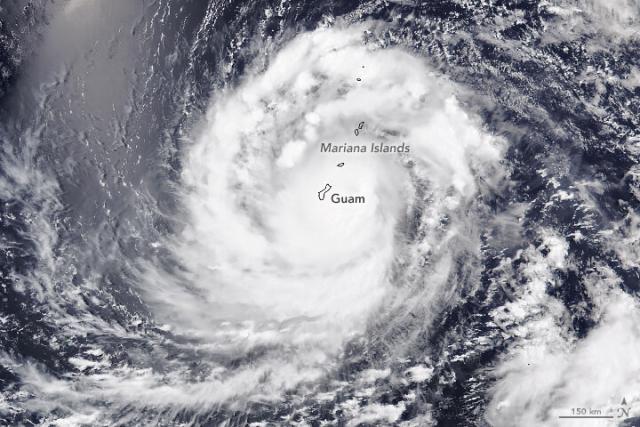
Typhoon Mawar was one of the strongest in decades to lash the U.S. territory of Guam.
When @noaa-20 captured this image on May 24, the storm carried sustained winds of about 140 miles (225 kilometers) per hour—equivalent to a category 4 storm. go.nasa.gov/3BRB8D7 🌀
#NASAEarth
Typhoon Mawar
The category 4 storm was one of the strongest in decades to lash the U.S. territory of Guam.go.nasa.gov
Launching soon: NASA’s TROPICS is a constellation of CubeSats that will help scientists learn more about tropical cyclones like Mawar. 🛰️ 🌀
The satellites will collect information about temperature, precipitation, water vapor, and clouds. go.nasa.gov/3BRB8TD
#NASAEarth
NASA, Rocket Lab Announce Coverage for Second TROPICS Launch
After successfully launching the first pair of small satellites earlier this month from New Zealand, NASA and Rocket Lab are now targeting no earlier than 1:30 a.m. EDT Monday, May 22 (5:30 p.m.Roxana Bardan (NASA)
