Search
Items tagged with: qgis
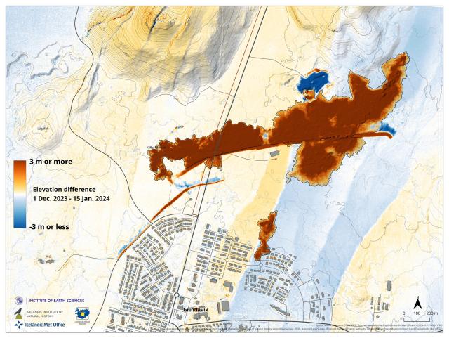
Elevation difference map (vertical displacement) based on two different acquisitions by our remote sensing team. These area base on two DEMs spanning 1 Dec. to 15 Jan. covering the latest eruption in #Grindavík
Reds:
- New lava fields
- Lava barriers
Blues:
- Quarry for barriers
- Barrier entrenchment
- Graben formation

