Search
Items tagged with: Landsat
NASA Data Reveals Role of Green Spaces in Cooling Cities - NASA Science
As any urban dweller who has lived through a heat wave knows, a shady tree can make all the difference.science.nasa.gov
NASA Data Reveals Role of Green Spaces in Cooling Cities - NASA Science
As any urban dweller who has lived through a heat wave knows, a shady tree can make all the difference.science.nasa.gov
This is fun
Your Name In Landsat
hackaday.com/2024/08/31/your-n…
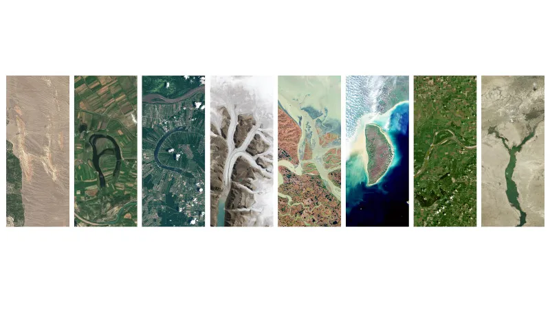
Your Name In Landsat
We’re guessing most readers can cite things from their youth which gave them an interest in technology, and spurred on something which became a career or had a profound impact on their life. …Hackaday
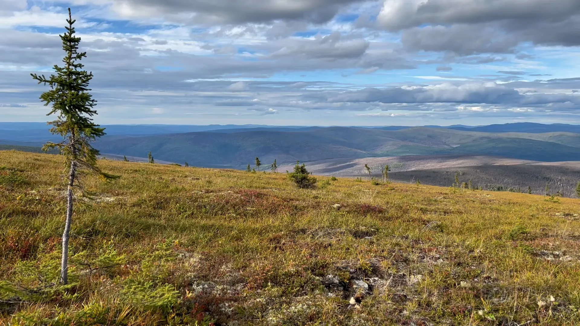
Tundra Vegetation to Grow Taller, Greener Through 2100, NASA Study Finds - NASA
Warming global climate is changing the vegetation structure of forests in the far north. It’s a trend that will continue at least through the end of thisErica McNamee (NASA)
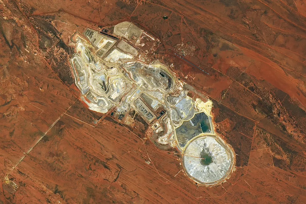
Telfer Mine, Western Australia - NASA
Landsat 9’s Operational Land Imager-2 captured this image of the open pits and ponds of Telfer Mine and the surrounding rust-colored soil on Dec. 15, 2023.NASA

NASA Selects Raytheon Company to Build Landsat Next Instruments - NASA
NASA selects Raytheon Company to provide three instruments and related services, with an option for one additional instrument, in support of the Landsat NextNASA
#NASAEarth
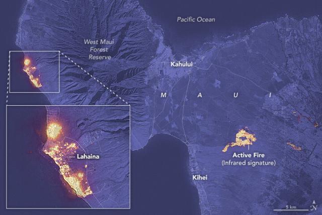
Devastation in Maui
Strong winds and dry weather helped fuel destructive wildfires on Hawaii’s second-largest island.go.nasa.gov
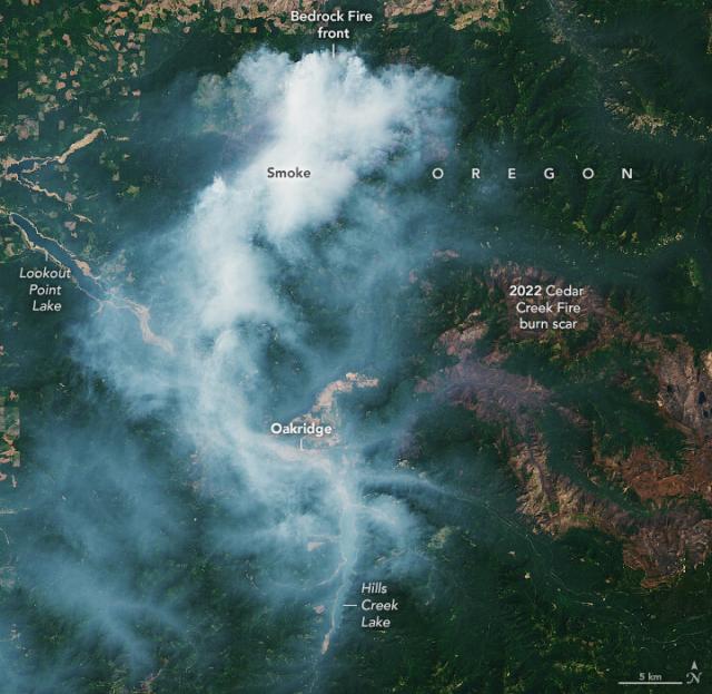
Wildfire season is picking up in the U.S.
60 fires are burning across nine states in the western U.S., fueled by hot and dry conditions. On August 1, #Landsat 9 captured this image of smoke streaming away from the Bedrock Fire in Oregon. go.nasa.gov/3Kscai8
#NASAEarth
Fire Season Heats Up in the West
Following a slow start to the fire season, several blazes burned across the western U.S. in early August.go.nasa.gov
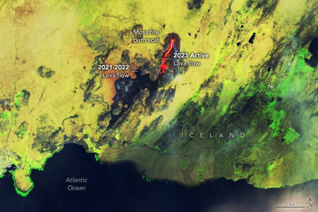
Iceland’s Fagradalsfjall volcano is erupting again, igniting unusually large and long-lasting wildfires in nearby moss that grows atop old lava flows. 🌋
This enhanced-color #Landsat 9 image shows active lava (orange) and burn scars from the moss fires. go.nasa.gov/3q98qeJ
#NASAEarth
Lava and Smoke Blanket Fagradalsfjall
Lava is once again spilling from the volcano in southwest Iceland, only this time it is igniting moss fires.go.nasa.gov
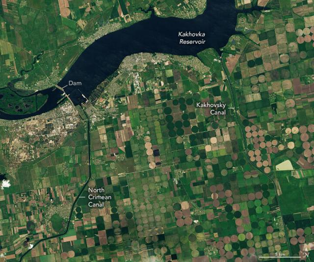
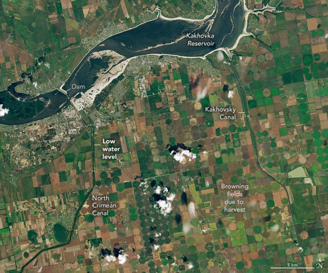
After the breach of Kakhovka Dam in June 2023, the adjacent reservoir drained, leaving farmers in southern Ukraine to cope with depleted water supplies.
These #Landsat images show the reservoir and two canals before (left) and after (right) the breach. go.nasa.gov/3Yh4rt2
#NASAEarth
Canals in Ukraine are Drying Up
After the breach of Kakhovka Dam and the flood that ensued, farmers in the area are coping with depleted water supplies.go.nasa.gov
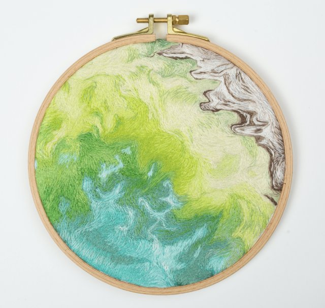
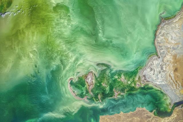
On #WorldEmbroideryDay, Earth inspires some creative threads. 🧵🌎
Artist Danielle Currie titled her piece 46.69, 50.43 after the coordinates of an image caught by #Landsat 8 of the Caspian Sea. go.nasa.gov/3Y8TI3E 🌊
#NASAEarth
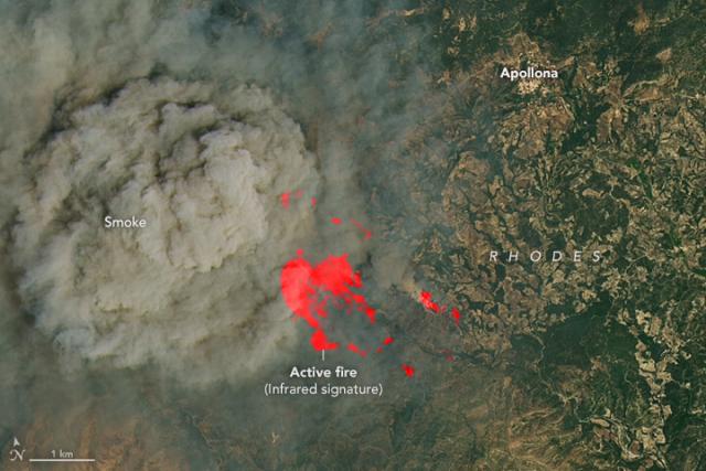
Wildfires broke out on the Greek island of Rhodes after a prolonged stretch of extreme heat.
Actively burning fires are marked by a red infrared signature in this image captured by #Landsat 8 on July 19. go.nasa.gov/3Q8xwF2
#NASAEarth
Fires Ignite on Greek Islands
Wildfires broke out on Rhodes and other islands amid record heat, forcing thousands to evacuate.go.nasa.gov
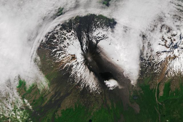
After three quiet years, the Shishaldin volcano in Alaska’s Aleutian Islands erupted this month. 🌋
Ash fallout from the eruptions can be seen on the southern flanks of the volcano in this image captured by #Landsat 8 on July 17, 2023. go.nasa.gov/3DwFIaF
#NASAEarth
Shishaldin Erupts
Ash from recent eruptions blackened the snow-covered flanks of the Alaskan volcano.go.nasa.gov
Now, Landsat Next is on the horizon 🌅
With a trio of smaller satellites that can each detect 26 wavelengths of light and thermal energy,
@nasa/@USGS #Landsat Next will provide finer resolution and more frequent data to monitor Earth’s changing surface. go.nasa.gov/3va23GU
[Video embedded in original tweet]
#NASAEarth

Next up to Continue NASA/USGS’s Landsat Legacy
With a trio of smaller satellites that can each detect 26 wavelengths of light and thermal energy, the Landsat Next mission is expected to look very different from its predecessors that have been observing Earth for 50 years.Kate Ramsayer (NASA)
Together, OLI and TIRS study all parts of Earth’s surface every 16 days.
From land to ice to sea, the open data provided by the #Landsat program has contributed to a deeper understanding of our changing planet. #OpenScience
#NASAEarth
#Landsat 8 and 9 also measure land surface temperature with Thermal Infrared Sensor (TIRS) and TIRS-2. These data are crucial for water management and ice detection.
#DYK that TIRS almost didn’t exist? Now it’s been imaging Earth for over a decade! go.nasa.gov/3OSCDbH
#NASAEarth
Ten Years of TIRS: Data for a Thirsty World | Landsat Science
Landsat 8 very nearly flew without a thermal infrared sensor. This is the backstory of how TIRS made it onto Landsat 8.https://landsat.gsfc.nasa.gov/article/author/lrocchio/#author (Landsat Science)
51 years of eyes on Earth 👀🛰
Since 1972, the #Landsat program has been studying Earth’s land, water, ice and more.
There are currently three active @nasa @usgs Landsat satellites orbiting Earth — Landsat 7, 8, and 9 — with Landsat Next on the horizon. go.nasa.gov/3Nxxl4w
#NASAEarth
Landsat Science
This joint NASA/USGS program provides the longest continuous space-based record of Earth’s land in existence.Landsat Science
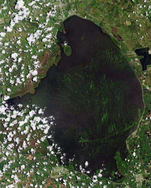
Algae has covered about half of Florida’s largest freshwater lake, Lake Okeechobee, for much of June and early July 2023.
The @nasa/@usgs #Landsat 9 satellite captured this image of the algae bloom on June 12, which is producing harmful toxins. go.nasa.gov/44qmL5a
#NASAEarth
Algae Bloom in Lake Okeechobee
Cyanobacteria covered over half of the surface of Florida’s largest freshwater lake in mid-June 2023.go.nasa.gov
Pitstop ahead ✅
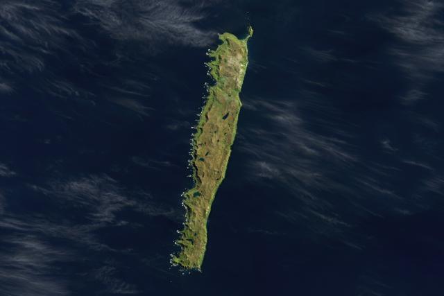
Macquarie Island, located halfway between Australia and Antarctica, has been an important stopping place for Antarctic explorers and breeding populations of penguins and seals. 🐧
#Landsat 9 captured this image in 2022. go.nasa.gov/44GtNCu
#NASAEarth
A Waypoint in the Southern Ocean
Remote Macquarie Island has been a stopover for Antarctic explorers and breeding populations of penguins and seals.go.nasa.gov
Happy #NationalCameraDay! While not a camera per se, #Landsat’s OLI instrument captures beautiful images of our planet. 🌍
The imager on the upcoming Landsat Next satellites will see changes on Earth’s surface with more precise detail than ever before. go.nasa.gov/3CSga7v
#NASAEarth
Landsat Next | Landsat Science
A New and Revolutionary Landsat Mission Landsat Next is on the horizon—the new mission will not only ensure continuity of the longest space-based record of Earth’s land surface, it will fundamentally transform the breadth and depth of actionable info…Landsat Science
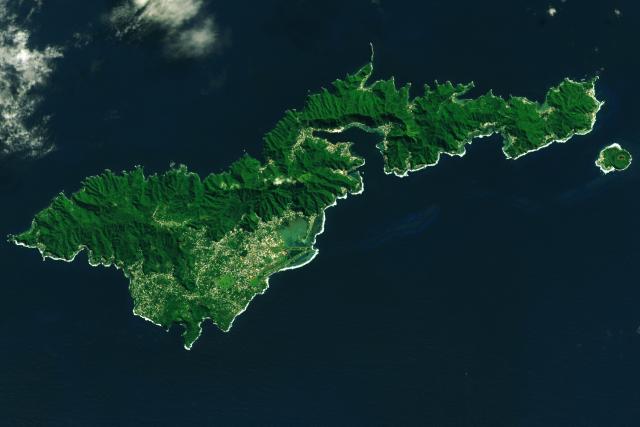
NASA scientists are mapping ground changes on earthquake-prone islands like Tutuila, the largest American Samoa island, in this #Landsat 8 image.🏝️
They found that Tutuila sank an average 6-9 mm per year from 2015-2022, compared to 1-2 mm before 2009. go.nasa.gov/3r1XRKg
#NASAEarth
Tutuila Island, American Samoa
Volcanoes, rainforests, and reefs abound in this tropical U.S. territory.go.nasa.gov
Noctiluca, is that you?
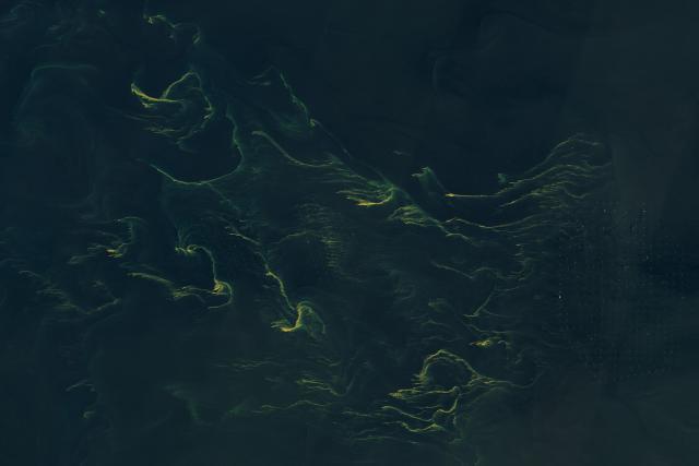
The @nasa / @usgs #Landsat 9 satellite captured this image of swirling tendrils of phytoplankton – which appear to be Noctiluca scintillans – off the coast of Germany's East Frisia Islands on June 14, 2023. #WorldOceansMonth
🌊 : go.nasa.gov/3JryeZU
#NASAEarth
Noctiluca in the North Sea?
These swirling tendrils of phytoplankton might be Noctiluca scintillans—a type of marine dinoflagellate known to inhabit this area.go.nasa.gov
#NASAEarth
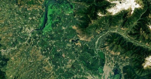
Shrinking Lakes of the Kashmir Valley
Two of the largest lakes in India’s Jammu and Kashmir region have declined in recent years, with implications for water security.go.nasa.gov
Refill, please! 🥛
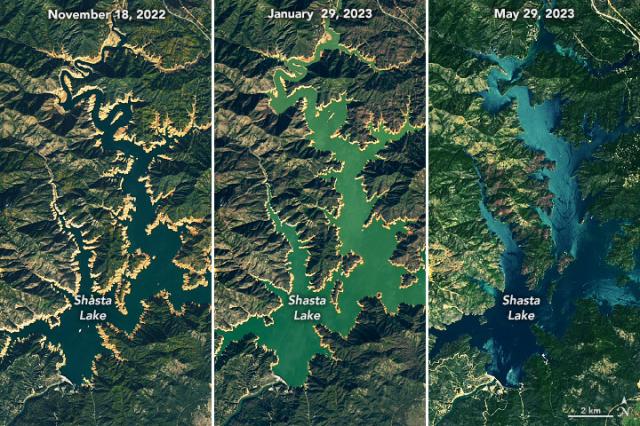
Shasta Lake, California’s largest reservoir, filled to nearly 100% capacity last month. Heavy rains and meltwater from an above-average snowpack earlier this year helped counter a prolonged drought. go.nasa.gov/43Pmok7
#Landsat watched it fill up ⤵️
#NASAEarth
California Reservoir Rebound
Shasta Lake refilled in spring 2023 after a season of heavy rain and snowmelt.go.nasa.gov
Are you a summer or winter person? ☀️❄️
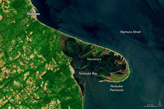
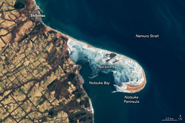
The Nemuro Strait in these #Landsat images is one of the largest sand spits in Japan. In the summer, sea grass and kelp can be seen in Notsuke Bay, while in the winter, the bay’s shallow waters freeze over.
A Sandy Haven in Japan
The shallow waters of hook-shaped Notsuke Peninsula shelter sea grass and shrimp in eastern Hokkaido.go.nasa.gov
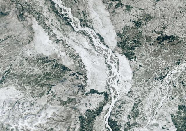
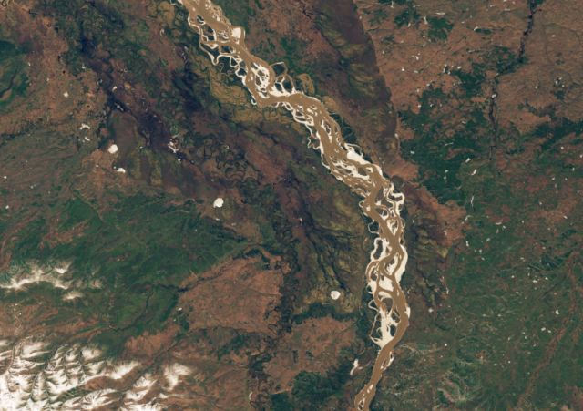
Melting winter snowpack and river ice breaking up caused damaging floods along Alaskan rivers in May 2023. go.nasa.gov/3Ww0PlX
These #Landsat images show the Yukon River transforming from a frozen, snowy landscape to a thawed one in just 8 days.
#NASAEarth
A Tumultuous Spring Breakup
Rapid thawing in Alaska caused damaging river floods in May 2023.go.nasa.gov
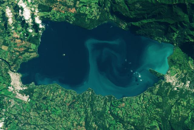
Toxic algae blooms are becoming more frequent in some lakes, including Chile’s Lake Villarrica seen in this #Landsat image.
The blooms are likely caused by warmer surface waters and nutrient-laden runoff from urban or agricultural areas. go.nasa.gov/423UHCA
#NASAEarth
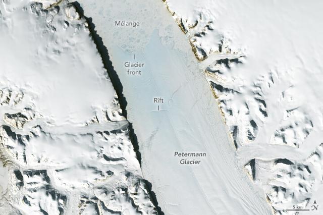
As the glacier stretches and thins, it becomes more prone to rifts that can break and form icebergs.
This @nasa @usgs #Landsat 8 image shows a rift on the floating ice tongue, acquired on May 14, 2023. go.nasa.gov/43bj6ra
#NASAEarth
Retreat at Petermann Glacier
Decades of retreat are visible from above, but harder-to-see changes below the waterline could also affect this iconic glacier’s future.go.nasa.gov
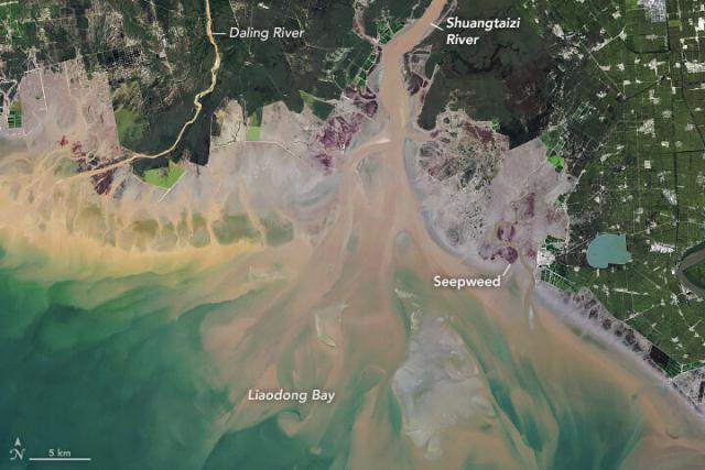
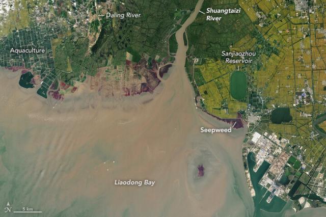
These #Landsat images show the same estuary in northeastern China 36 years apart.
A salt-loving seepweed turns the coast a deep red in the fall, which highlights how the estuary has changed due to coastal developments from 1986 (left) to 2022 (right). go.nasa.gov/3oen6YS
#NASAEarth
A Changing Estuary Lined With Red
Satellite observations of seepweed are helping scientists track how these treasured, colorful plants are faring as coastal landscapes in northeastern China change.go.nasa.gov
#NASAEarth
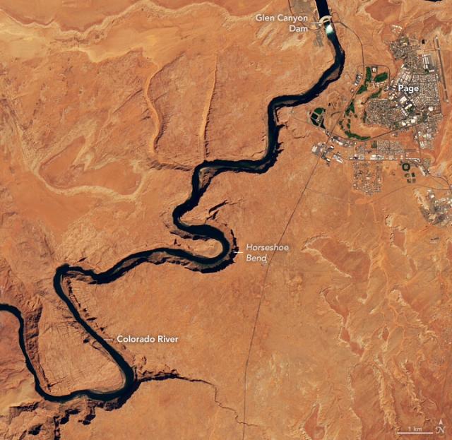
High Flow at Glen Canyon Dam
Water managers released a surge of water from the dam in late April to help preserve shrinking sandbars and shoreline habitats downstream.go.nasa.gov
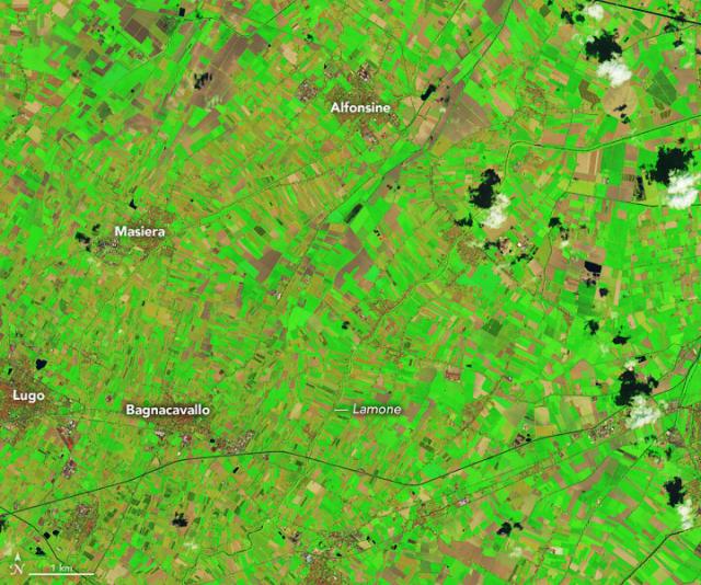
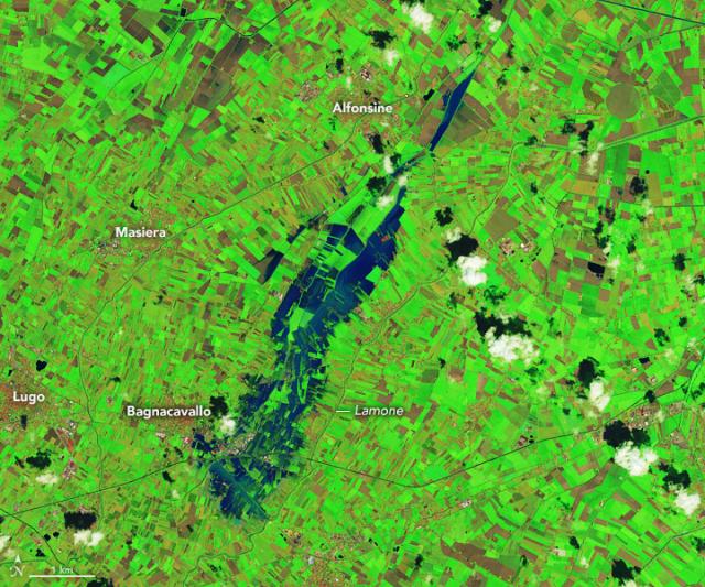
Heavy rains caused flash flooding and landslides in northern Italy on May 2–3, 2023. 🌧
#Landsat satellites captured these enhanced-color images of flooding near the Lamone river before (left) and after (right) the rains. go.nasa.gov/3LPXWaO
#NASAEarth
A Deluge in Italy
Heavy rains caused destructive flash flooding in the Emilia-Romagna region.go.nasa.gov
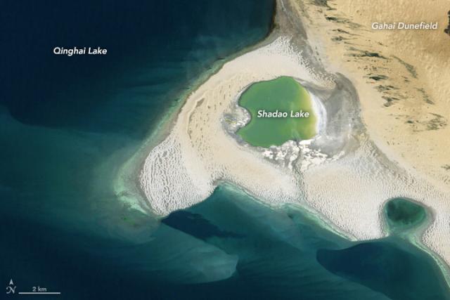
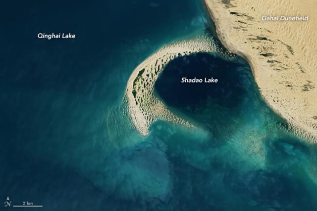
The shape of western China’s Qinghai Lake changes as the region’s climate shifts, researchers say.
As water levels drop due to warming trends, dunes build up and divide the lake into several sub-lakes, like Shadao Lake in these #Landsat images. go.nasa.gov/3nHiB9b
#NASAEarth
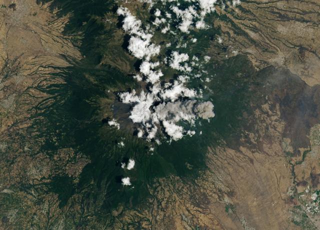
Popocatépetl is one of Mexico’s most active volcanoes. 🌋
Its current eruption has been ongoing since 2005. In spring 2023, both #Landsat 8 (left) and @Space_Station astronauts (right) captured images of the volcanic plumes. go.nasa.gov/3nExl8y
#NASAEarth
Popocatépetl Volcano Keeps on Puffing
One of Mexico’s most active volcanoes continues to put on a show for satellites and astronauts.go.nasa.gov
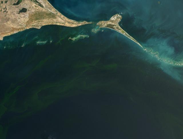
Multiple studies show dangerous algae blooms have become more frequent and intense in the Gulf of Mannar since 2019.
This #Landsat 9 image from Sep. 23, 2022 shows a bloom in the Gulf of Mannar, off the southeastern coast of India. go.nasa.gov/42xvhhx
#NASAEarth
Deadly Blooms in the Gulf of Mannar
Though Noctiluca scintillans blooms have long been noted in the shallow gulf, they have become more frequent and intense since 2019.go.nasa.gov
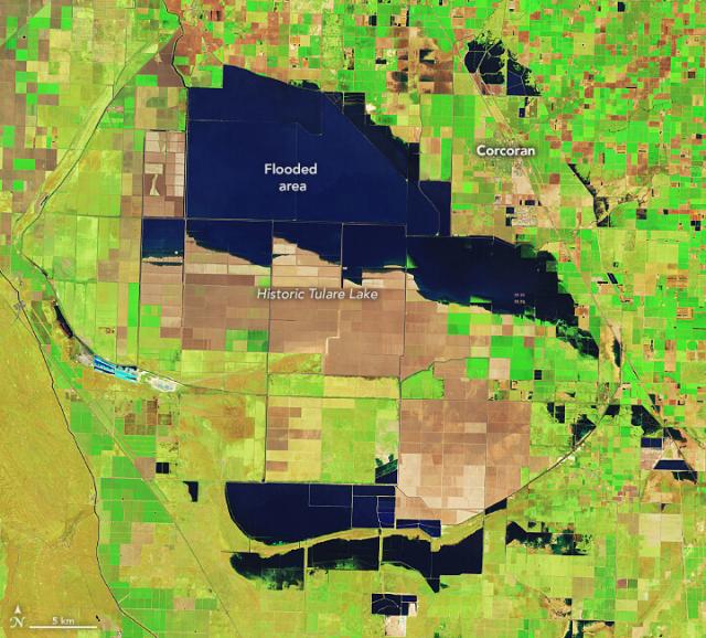
Update on Tulare Lake: still growing.
The historic lakebed, now covered with farms that grow a variety of crops, is flooded after two major storms hit southern California. This enhanced-color image by #Landsat highlights the water in dark blue. go.nasa.gov/3NKKJCH
#NASAEarth
Tulare Lake Grows
Flooding in the California lakebed continues to spread as spring brings snowmelt from the Sierras.go.nasa.gov
🔗earthobservatory.nasa.gov/imag…
#NASAEarth
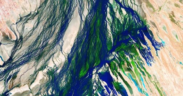
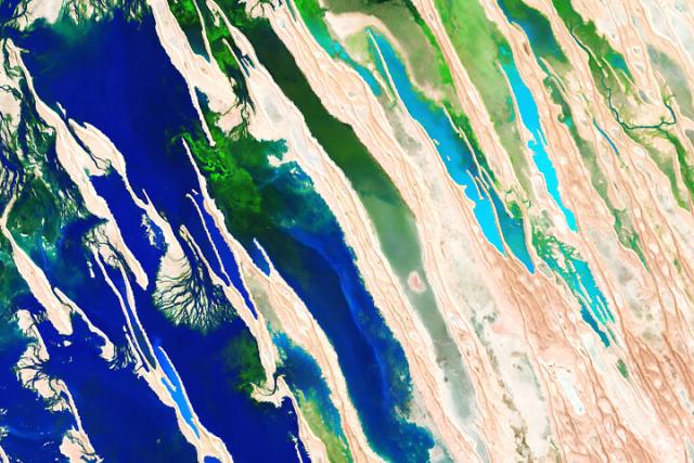
Seasonal Flooding of the Diamantina River
False-color images from Channel Country in the Australian Outback reveal a barren landscape transformed.earthobservatory.nasa.gov
Scientists are using artificial intelligence to analyze 50 years’ worth of @usgs @NASA_Landsat data. 🌏 🛰️
These tools help scientists identify cloud cover or wildfire smoke in #Landsat images, map changes in land cover, and more. go.nasa.gov/3HsiNzB
#NASAEarth
From Orbit to A.I.—Harnessing Machine Learning with Landsat Data | Landsat Science
Over the past few years, machine learning techniques have been increasingly used to analyze the vast amount of data collected by the Landsat mission, which has been circling the globe for over 50 years.https://landsat.gsfc.nasa.gov/article/author/lrocchio/#author (Landsat Science)
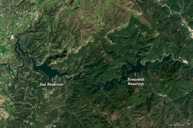
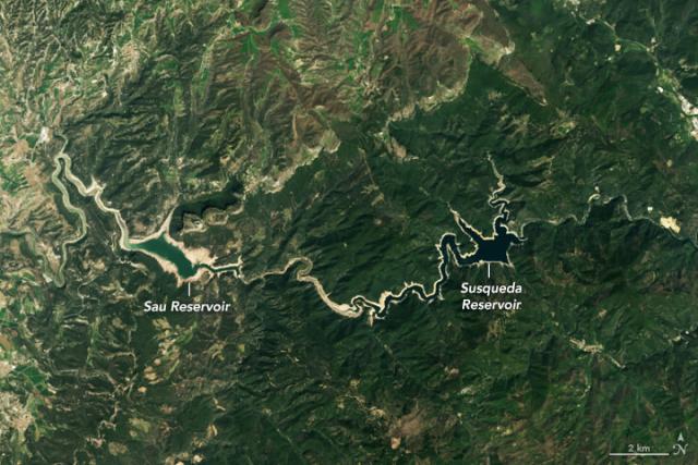
The Catalonia region of Spain is experiencing a long-term drought.
These #Landsat 8 images show the Sau and Susqueda Reservoirs in 2021 (left) and in April 2023 (right), which both have diminished water levels. go.nasa.gov/44bzrx6
#NASAEarth
Shrinking Reservoirs in Catalonia
Heat and drought have parched reservoirs in northeastern Spain.go.nasa.gov
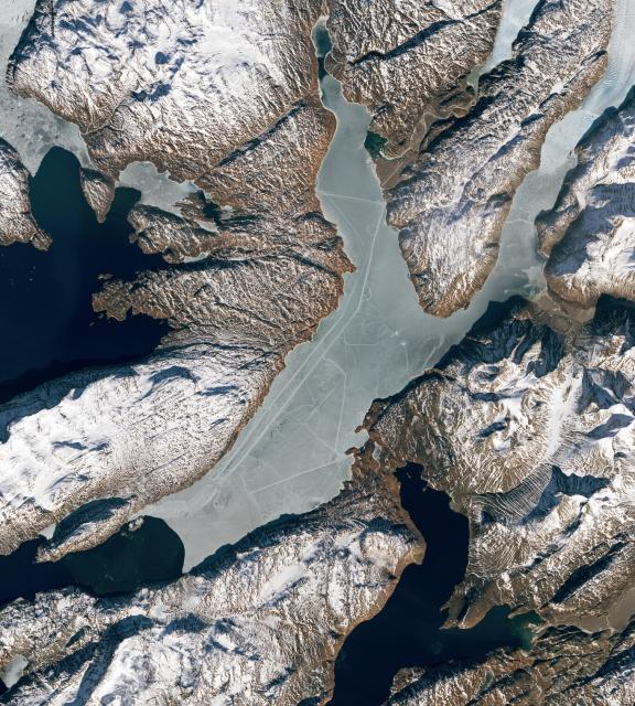
What are these marks in the ice? 🤔
On March 13, 2023, #Landsat 9 took these images of Tunulliarfik Fjord in Greenland. At the time, the fjord’s waters were capped with a layer of sea ice. 🌊🧊 go.nasa.gov/3V4P0m6
#NASAEarth
Curious Tracks Criss-Cross an Icy Fjord
Paths that cut across the still-frozen Tunulliarfik Fjord in southern Greenland were likely made by people.go.nasa.gov

